In the beginning:
The original survey of Sinclair township was made by John McAree and it was free grant land that attracted settlers to this township. Andrew Hart came to Sinclair Township in search of land about 1876. There was no road, but a path which led to the vicinity of Bella and Rebecca Lakes. He located his family on the property now know as Billy Bear where they farmed. A few settlers had horses, but most used oxen and they found a ready market for their produce when the lumber camps moved in to take off the timber.
With so many settlers arriving a log school was erected at the corner now know as the Limberlost Turn in the early 1880's. Some of the children attending had to walk up to 5 miles to the school. Church services were held in the same building.
The church building was erected in 1894 beside the cemetery and was named Mizpah. People came from as far away as Tasso and Nelson lakes and most had to walk to services. Families dwindled and both the church and the school closed. In 1927 the church was torn down and the red school at Limberlost Turn was constructed out of the lumber from the church.
The first and only post office in the settlement was at Antioch on Bella Lake. It was discontinued in 1918.
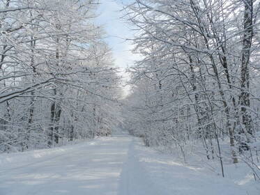
The road into Oxbow lake was built by the early settlers in 1876 and was called the Syndicate Road. It was not until the last war when the Norwegian Government went into exile at Interlaken, that the Department of Highways took over its maintenance. It has been known as the 514, Regional Road #8 and now Limberlost Road.
With many people settling on the North side of the East river, there was a wooden a bridge built. This opened up logging and hunt camps in the area. The horse change- up station for the loggers was located where the fire station sits now. A later bridge was built by Brookie (Edgar Brook of Brook’s Mill). This bridge was flooded out by hurricane Audrey in 1956 when several dams on the East river broke. A new bridge was built in 1968.
Limberlost Lodge was known as the premier Muskoka destination and was open year round. It was built in 1921 by Gordon Hill who was the grandson of Robert Hill, founder of the Hillside community on Hwy 60. To get from Huntsville to our road, you took a steamer boat to Tally Ho. Limberlost had 200 miles of trails for riding horses, hiking and cross country skiing. The property also includes the highest elevation in the area and so an alpine ski run was built with a 350 foot vertical, know as “Top of the World”. Gordon provided fishing camps and overnight horseback riding excursions. One of the stop-overs was at Interlaken where Olympia Sports Camp now stands.
On Oxbow Lake the Scott family farmed, and Scottie ran fish and hunt camps from the Lodge. He also trapped and cut ice blocks from the lake in winter, to be used in iceboxes in the summer. Scottie built the log cabins around the lodge and many others on the lake. The first two cottages near the lodge were owned by the Boyd/Galbraith family and the Wardell/Davie family. The Boyd’s owned the grocery store in Huntsville and the Wardell’s owned the dry goods store next door. These two properties in Huntsville are now Pizza Pizza and Algonquin Outfitters. On the East arm of the lake the island known as Ginny’s island had a log cabin built on it.
Vesle Skaugum (Beloved place in the woods) was built in 1942 at Interlaken. It was opened by King Olav V of Norway and modelled after the king’s country estate in Norway. The complex was used by Norwegian fighter pilots who took refuge here during the Second World War. The countryside on our lake resembled that of Norway and the pilots used their time here for further training manoeuvres and recreation. The camp was later used by the Toronto Kiwanis Club for a summer camp for under- privelidged boys. The land was unused for several years, then in 1979 it became Olympia Sports Camp.
In 1948 the Lands and Forests office opened up crown land on Oxbow lake. Several properties were purchased and the first few cottages where built at that time. Everyone left their boats at the lodge’s dock and all building materials (from Brook’s Mill) were taken down the lake to our lots for the cottages. This is also how we moved furniture, stoves, food and ourselves around the lake in those days, in wooden row boats with 5.5 pull start motors. Later the cottagers put in a road themselves on the West arm, and each maintained the portion at the back of their cottage. The road ended at Harper’s cottage, now #1379 and there was a dock on the property that people on the peninsula used to get across to their cottages. Later hydro came to the cottages and we could put away the coal oil lamps that were lit every evening. These hydro wires crossed over the lake in several places and we all held our breath when a float plane left the lake, watching to see that they missed the wires. Later the wires were buried on the lake bottom along with the phone lines that finally came. In later years the road was extended down the length of the peninsula and the municipality took over its maintenance.
The original survey of Sinclair township was made by John McAree and it was free grant land that attracted settlers to this township. Andrew Hart came to Sinclair Township in search of land about 1876. There was no road, but a path which led to the vicinity of Bella and Rebecca Lakes. He located his family on the property now know as Billy Bear where they farmed. A few settlers had horses, but most used oxen and they found a ready market for their produce when the lumber camps moved in to take off the timber.
With so many settlers arriving a log school was erected at the corner now know as the Limberlost Turn in the early 1880's. Some of the children attending had to walk up to 5 miles to the school. Church services were held in the same building.
The church building was erected in 1894 beside the cemetery and was named Mizpah. People came from as far away as Tasso and Nelson lakes and most had to walk to services. Families dwindled and both the church and the school closed. In 1927 the church was torn down and the red school at Limberlost Turn was constructed out of the lumber from the church.
The first and only post office in the settlement was at Antioch on Bella Lake. It was discontinued in 1918.
The road into Oxbow lake was built by the early settlers in 1876 and was called the Syndicate Road. It was not until the last war when the Norwegian Government went into exile at Interlaken, that the Department of Highways took over its maintenance. It has been known as the 514, Regional Road #8 and now Limberlost Road.
With many people settling on the North side of the East river, there was a wooden a bridge built. This opened up logging and hunt camps in the area. The horse change- up station for the loggers was located where the fire station sits now. A later bridge was built by Brookie (Edgar Brook of Brook’s Mill). This bridge was flooded out by hurricane Audrey in 1956 when several dams on the East river broke. A new bridge was built in 1968.
Limberlost Lodge was known as the premier Muskoka destination and was open year round. It was built in 1921 by Gordon Hill who was the grandson of Robert Hill, founder of the Hillside community on Hwy 60. To get from Huntsville to our road, you took a steamer boat to Tally Ho. Limberlost had 200 miles of trails for riding horses, hiking and cross country skiing. The property also includes the highest elevation in the area and so an alpine ski run was built with a 350 foot vertical, know as “Top of the World”. Gordon provided fishing camps and overnight horseback riding excursions. One of the stop-overs was at Interlaken where Olympia Sports Camp now stands.
On Oxbow Lake the Scott family farmed, and Scottie ran fish and hunt camps from the Lodge. He also trapped and cut ice blocks from the lake in winter, to be used in iceboxes in the summer. Scottie built the log cabins around the lodge and many others on the lake. The first two cottages near the lodge were owned by the Boyd/Galbraith family and the Wardell/Davie family. The Boyd’s owned the grocery store in Huntsville and the Wardell’s owned the dry goods store next door. These two properties in Huntsville are now Pizza Pizza and Algonquin Outfitters. On the East arm of the lake the island known as Ginny’s island had a log cabin built on it.
Vesle Skaugum (Beloved place in the woods) was built in 1942 at Interlaken. It was opened by King Olav V of Norway and modelled after the king’s country estate in Norway. The complex was used by Norwegian fighter pilots who took refuge here during the Second World War. The countryside on our lake resembled that of Norway and the pilots used their time here for further training manoeuvres and recreation. The camp was later used by the Toronto Kiwanis Club for a summer camp for under- privelidged boys. The land was unused for several years, then in 1979 it became Olympia Sports Camp.
In 1948 the Lands and Forests office opened up crown land on Oxbow lake. Several properties were purchased and the first few cottages where built at that time. Everyone left their boats at the lodge’s dock and all building materials (from Brook’s Mill) were taken down the lake to our lots for the cottages. This is also how we moved furniture, stoves, food and ourselves around the lake in those days, in wooden row boats with 5.5 pull start motors. Later the cottagers put in a road themselves on the West arm, and each maintained the portion at the back of their cottage. The road ended at Harper’s cottage, now #1379 and there was a dock on the property that people on the peninsula used to get across to their cottages. Later hydro came to the cottages and we could put away the coal oil lamps that were lit every evening. These hydro wires crossed over the lake in several places and we all held our breath when a float plane left the lake, watching to see that they missed the wires. Later the wires were buried on the lake bottom along with the phone lines that finally came. In later years the road was extended down the length of the peninsula and the municipality took over its maintenance.